
Orlando Weather: Drier Ahead of Weekend Rain
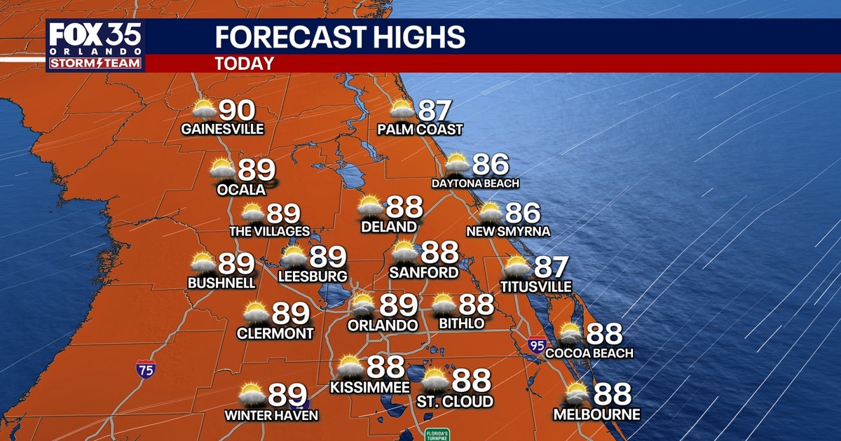
Orlando residents will experience drier conditions through Thursday, offering a temporary break before scattered showers and storms are expected to return for the weekend. A pocket of drier air will limit rain chances to 20% or less on Thursday. A persistent northeasterly breeze off the Atlantic will still carry isolated to scattered showers inland, with afternoon wind gusts reaching 15-25 mph. High temperatures will be in the mid-to-upper 80s, with overnight lows in the 70s.
Beachgoers and boaters should exercise caution. The steady onshore wind contributes to rough surf and a high risk of dangerous rip currents. Entering the surf is not advised. Offshore seas are elevated but expected to improve gradually.
The weather pattern shifts Friday as an upper-level low crosses Florida from east to west. This system will bring deeper tropical moisture and colder air aloft, creating an unstable atmosphere. Residents can anticipate scattered to numerous showers and storms daily from Friday through Sunday. These storms may form earlier than typical sea breeze-driven summer storms.
Primary threats from the weekend storms include frequent lightning, small hail, and gusty winds of 40-50 mph in stronger cells. Localized downpours of 1-3 inches are possible, potentially leading to minor flooding. High temperatures will remain in the upper 80s.
Unsettled weather is forecast to continue into early next week. As the upper low moves west of Florida, ample moisture will remain, pumping northward from the Caribbean. Scattered to numerous afternoon and evening storms are likely Monday through Wednesday, with the sea breeze as the main trigger for development.
In the tropics, a low-pressure system several hundred miles east of Bermuda shows some organization, with the National Hurricane Center assigning it a 40% chance of development over the next 48 hours and seven days. This system is expected to move slowly west before potentially turning south on Friday. No immediate threat to Florida has been indicated.



Discussion (0)
Join the Conversation
No comments yet. Be the first to comment!