
Photo Gallery
Community photos and memories
No photos found.
Community Photos
Photos from local communities and photographers

Historic National Road - Diorama of The Historic National Road - NARA - 7719403
Scope and content: The original finding aid described this photograph as: Original Caption: A woman in the Zane Grey Museum examines the dioramas which detail the building of the Historic National Road through the years. Location: Location: Zanesville, Ohio (39.941° N 81.996° W) Status: Public domain. Photo by A. E. Crane
Wikimedia Commons (public domain)

Historic National Road - Display at Zane Grey Museum - NARA - 7719401
Scope and content: The original finding aid described this photograph as: Original Caption: A woman considers this display of Zane Grey in his study at the Zane Grey Museum just outside of Zanesville. Location: Location: Zanesville, Ohio (39.940° N 82.004° W) Status: Public domain. Photo by A. E. Crane
Wikimedia Commons (public domain)

Historic National Road - Outside the Zane Grey Museum - NARA - 7719337
Scope and content: The original finding aid described this photograph as: Original Caption: A fall tree conceals the Zane Grey Museum in the background. In the foreground is a small, charming bridge. Location: Location: Zanesville, Ohio (39.943° N 82.011° W) Status: Public domain. Photo by A. E. Crane
Wikimedia Commons (public domain)

Images from American State Papers, Military Affairs, Vol. 4 (1860) 04
Images from American State Papers, Military Affairs, Vol. 4 (1860)
Wikimedia Commons (public domain)

Incense Burner - DPLA - 2cedcf51793c3093b5f10a22cc91d2bd
Zanesville Pottery incense burner depicting a woman holding a bowl. Marlo Bartels took several pictures of architecture in Columbus on his first visit in 1988 to document ideas for the ceramic tile mural he designed and installed at the Home Savings of America Bank at 5091 N. High St. He was also very interested in Zanesville pottery.
Wikimedia Commons (public domain)
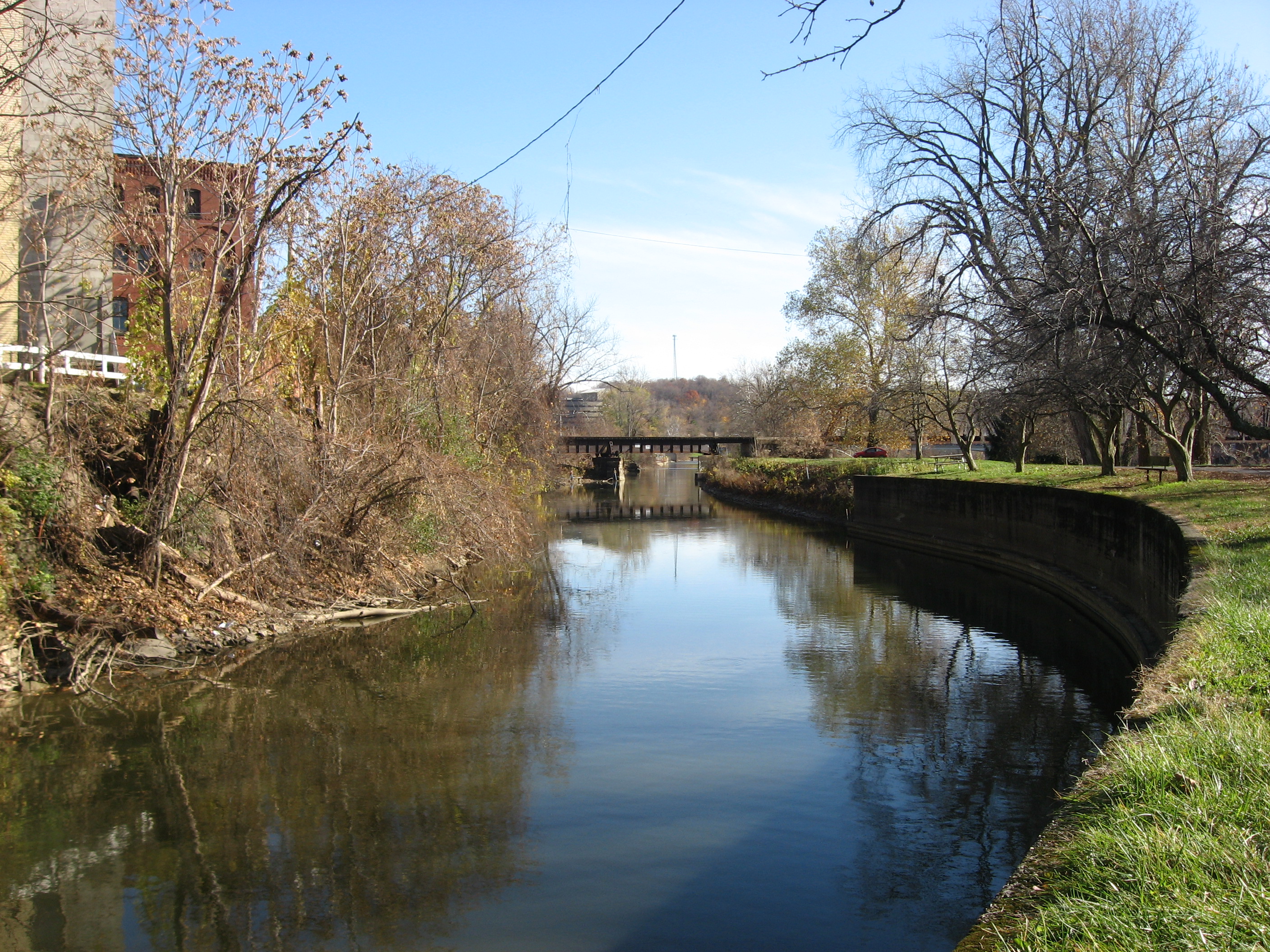
Muskingum River Canal at Zanesville
Looking downstream along the Muskingum River Canal at Zanesville, Ohio, United States. Constructed in 1841, the Zanesville waterfront portion of the canal is listed on the National Register of Historic Places. Photo is taken from the former canal towpath — now a footpath — on the riverside bank of the canal.
Wikimedia Commons (public domain)

Muskingum Salt Reservations
This map is of land tracts in en:Ohio associated with the en:Salt Reservations of the en:Ohio Lands.
Wikimedia Commons (public domain)

Ohio's second statehouse - Zanesville
Ohio's second statehouse - Zanesville. From 1810 to 1812, Zanesville, Ohio was the state capital. In 1809 this building was erected. After the capital was moved back to Chillicothe, Ohio, this building served as the county courthouse of Muskingum County, Ohio until 1874, when the present courthouse was built.
Wikimedia Commons (public domain)

Putnam Historic District, Zanesville
Northward along Putnam Avenue (U.S. Route 22) between its intersections with Van Buren and Madison Streets in southern Zanesville, Ohio, United States. The neighborhood pictured is part of the Putnam Historic District, a historic district that is listed on the National Register of Historic Places.
Wikimedia Commons (public domain)

Range Book v. 21- Range 14, Town 11 (Trimble Township, Athens County, Ohio) - DPLA - 1e1eb2af6fc2729e855d4507f47302d8 (page 266)
One of 26 photographic scrapbooks created by W.E. Peters that document cemeteries, Native American mounds, one-room school houses, mining sites, and other features of Athens and its surrounding areas. Peters focused particularly on features he believed were being damaged or disappearing. This scrapbook covers Trimble Township, Athens County, Ohio, and includes content relating to surrounding areas in Muskingum and Perry Counties.
Wikimedia Commons (public domain)

View of the New Suspension Bridge, Dresden, Ohio - DPLA - cd72dad183e586e4e9f7b165784ce954 (page 2)
A view of the new suspension bridge over the Muskingum River in Dresden, Ohio.
Wikimedia Commons (public domain)

WmBHarrisFront
Wikimedia Commons (public domain)