
Photo Gallery
Community photos and memories
No photos found.
Community Photos
Photos from local communities and photographers

Winfield Junction jeh
Looking east from eastbound Main Line train at Winfield Junction on a cloudy midday.
Wikimedia Commons (cc0)

ON QUEENS BOULEVARD IN QUEENS, HEADED TOWARD THE EAST RIVER AND MANHATTAN - NARA - 549886
Wikimedia Commons (public domain)
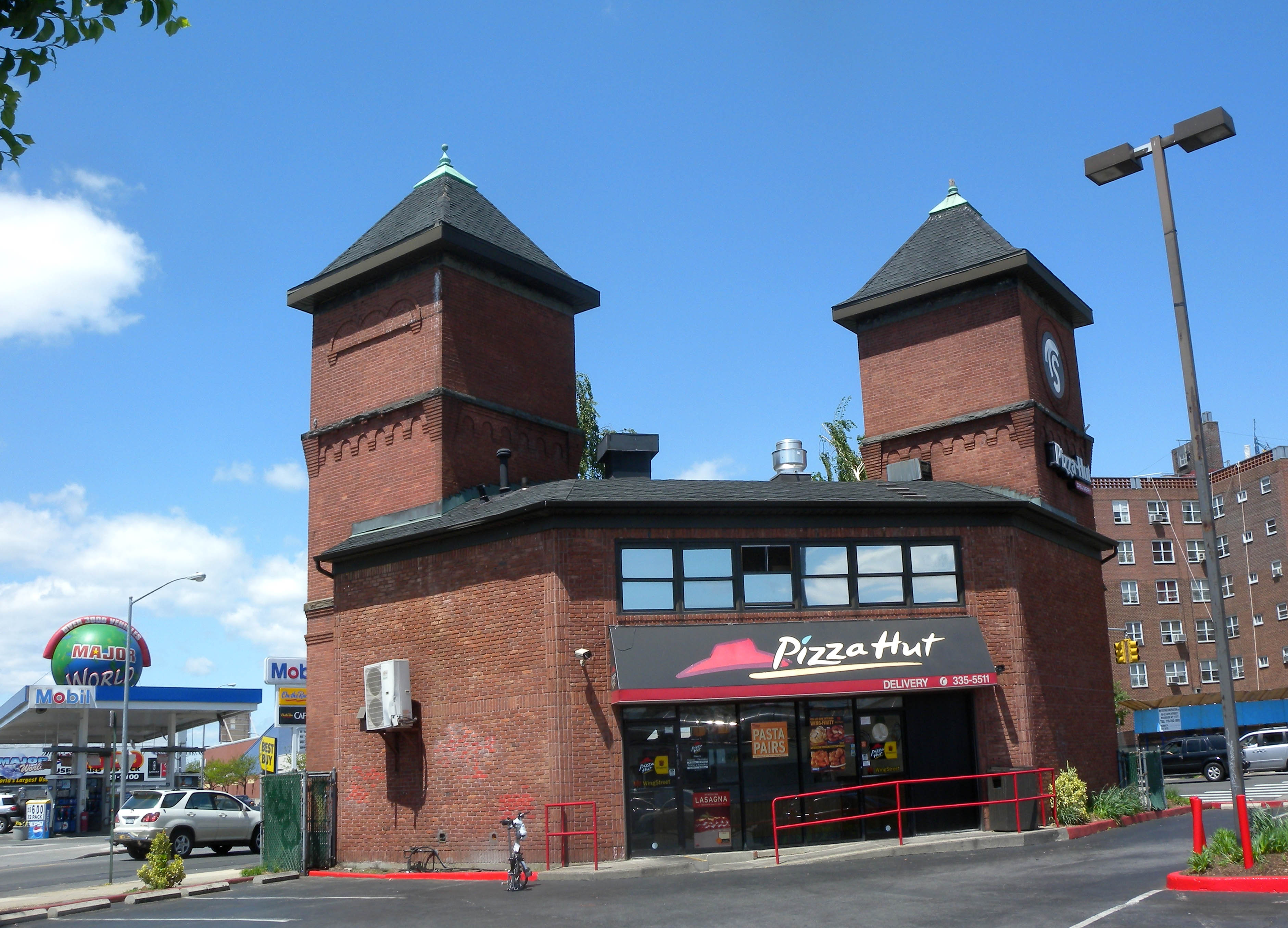
Steinway Railway Woodside barn jeh
Looking northwest at former car barn of Steinway Railway at Woodside Avenue (left) and Northern Boulevard (background) on a sunny midday.
Wikimedia Commons (public domain)

1909AtlasPlate13-Newtown-Ward2-Woodside-NYPL
1909 Atlas sheet showing Queens Ward 2 (encompassing the village of Woodside). This property map, used for fire insurance purposes, shows houses and other buildings, streets, rail and trolley lines, and elevation and hydrants.
Wikimedia Commons (public domain)

1 Bulova Avenue jeh
Looking west at Executive Offices on a sunny morning.
Wikimedia Commons (cc0)

Acela 58 St 31 Av NYCRR jeh
Looking east from 58th St along a restaurant parking lot as southbound Acela passes another train in Sunnyside Junction on a sunny afternoon.
Wikimedia Commons (cc0)

Boulevard Gardens 1
Interior of Boulevard Gardens, an apartment complex in Woodside, New York
Wikimedia Commons (cc0)

Bwy 58 Queens IND vent jeh
Looking southeast along Broadway at 58th Street and vents for en:IND Queens Boulevard Line subway on a sunny midday.
Wikimedia Commons (public domain)

Corpus Christi School 31 st Av jeh
Looking south from 31st Avenue at Corpus Christi school on a sunny morning.
Wikimedia Commons (cc0)

HillsideManorHouseAtWoodside
This decayed tintype shows "Hillside Manor" in the 1870s. The house, sited on high point not far from the Great Chestnut Tree in Woodside, lay on nine acres of land with gardens laid out by Frederick Law Olmsted. Owned by Louis Windmuller, German immigrant, New York merchant, financier, and philanthropist, the estate was one of the last in Woodside to be sold for development. In the late 1930s the family sold about half the land for multistory apartment buildings and donated the other half to
Wikimedia Commons (public domain)

Immanuel Baptist Ch 68-10 31st Ave jeh
Looking west at Immanuel Baptist on a sunny morning.
Wikimedia Commons (cc0)

Mary Winfield RCC 47 72 jeh
Looking southwest at St Mary's Winfield Roman Catholic Church on a sunny late afternoon.
Wikimedia Commons (cc0)

Old Tracks and Routes in Newtown - Crop
A 1912 map from the Historical Guide to the City of New York, showing roads and rail lines ("tracks and routes") in what was then the Town of Newtown, now western Queens. This is cropped from the original.
Wikimedia Commons (public domain)

Old Tracks and Routes in Newtown (Plate LIV, p. 272)
This map shows locations in Woodside and surrounding areas of Queens from both colonial times and the period in which it was made (1908-1912). It is oriented so the the south-to-north axis is from bottom left to top right. Modern Woodside is shown as "Woodside" and "North Woodside." It is bounded by Long Island City in the west, Laurel Hill and Winfield in the south, Elmhurst and Corona in the east, and North Beach in the north. Flushing (not shown) also lies to the north. The map contains
Wikimedia Commons (public domain)