
Photo Gallery
Community photos and memories
No photos found.
Community Photos
Photos from local communities and photographers

11012013 - Williamsburg KY 12 (10673535436)
11012013 - Williamsburg KY 12
Wikimedia Commons (public domain)

11012013 - Williamsburg KY 14 (10673538866)
11012013 - Williamsburg KY 14
Wikimedia Commons (public domain)

11012013 - Williamsburg KY 16 (10673482445)
11012013 - Williamsburg KY 16
Wikimedia Commons (public domain)

11012013 - Williamsburg KY 28 (10673486045)
11012013 - Williamsburg KY 28
Wikimedia Commons (public domain)

11012013 - Williamsburg KY 37 (10673777453)
11012013 - Williamsburg KY 37
Wikimedia Commons (public domain)

11012013 - Williamsburg KY 49 (10673780963)
11012013 - Williamsburg KY 49
Wikimedia Commons (public domain)

11012013 - Williamsburg KY 67 (10673473325)
11012013 - Williamsburg KY 67
Wikimedia Commons (public domain)

11012013 - Williamsburg KY 80 (10673489325)
11012013 - Williamsburg KY 80
Wikimedia Commons (public domain)

11012013 - Williamsburg KY 85 (10673563134)
11012013 - Williamsburg KY 85
Wikimedia Commons (public domain)

11012013 - Williamsburg KY 94 (10673775133)
11012013 - Williamsburg KY 94
Wikimedia Commons (public domain)

Ancil Gatliff House
Front of the Dr. Ancil Gatliff House, located on the southern side of Fifth Street at the Main Street (Kentucky Route 296) intersection in Williamsburg, Kentucky, United States. Built in 1885, it is listed on the National Register of Historic Places.
Wikimedia Commons (public domain)

Flooded areas, Cumberland River, Clear Fork, and Brier Creek, vicinity of Williamsburg, Ky. LOC gm69003387
Scale ca. 1:62,000. Folded title: Floods in Williamsburg, Kentucky--How to avoid damage. Includes 2 "Flood elevations" charts. Text and illus. on verso. Available also through the Library of Congress Web site as a raster image. AACR2: 110; 650/1; 650/2
Wikimedia Commons (public domain)

J.B. Gatliff House
Front and southern side of the J.B. Gatliff House, located on the southeastern corner of the junction of Main (Kentucky Route 296) and Tenth (Kentucky Route 2386) Streets in Williamsburg, Kentucky, United States. Built in 1909, it is listed on the National Register of Historic Places.
Wikimedia Commons (public domain)
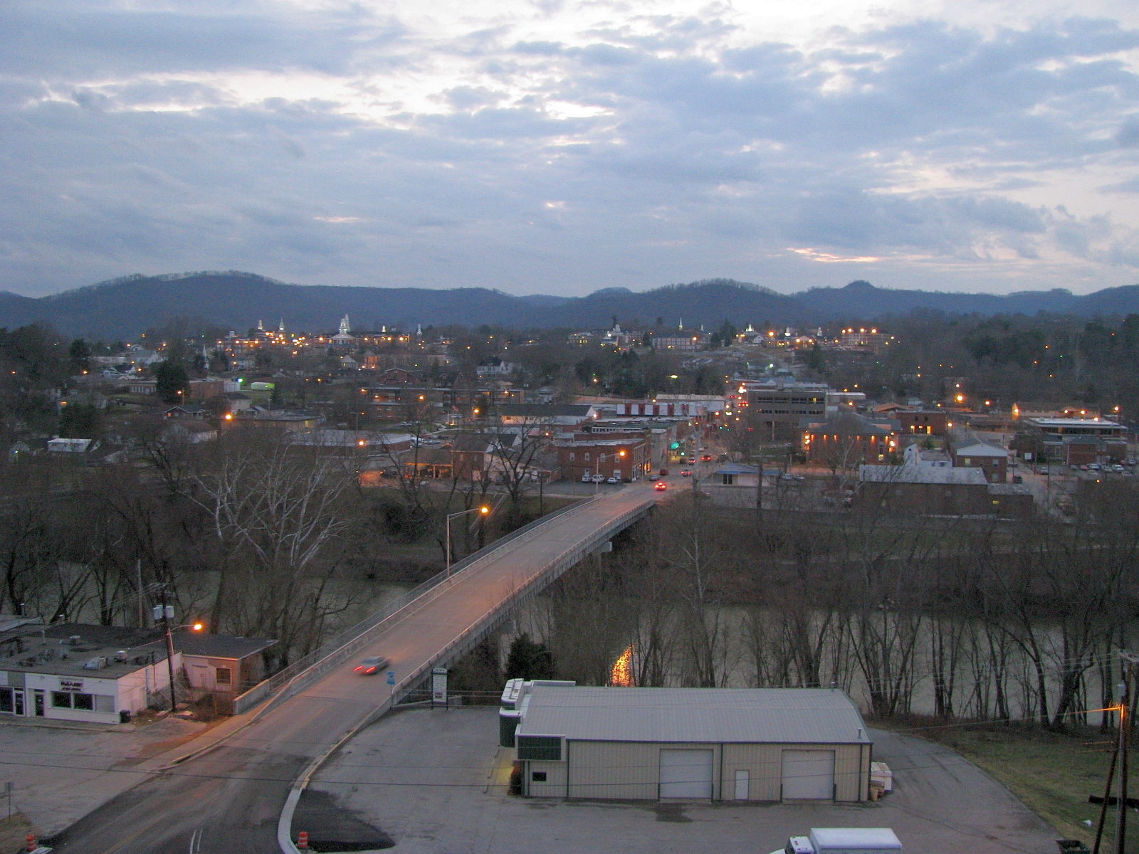
Williamsburg, Kentucky
View of Williamsburg Kentucky.
Wikimedia Commons (public domain)
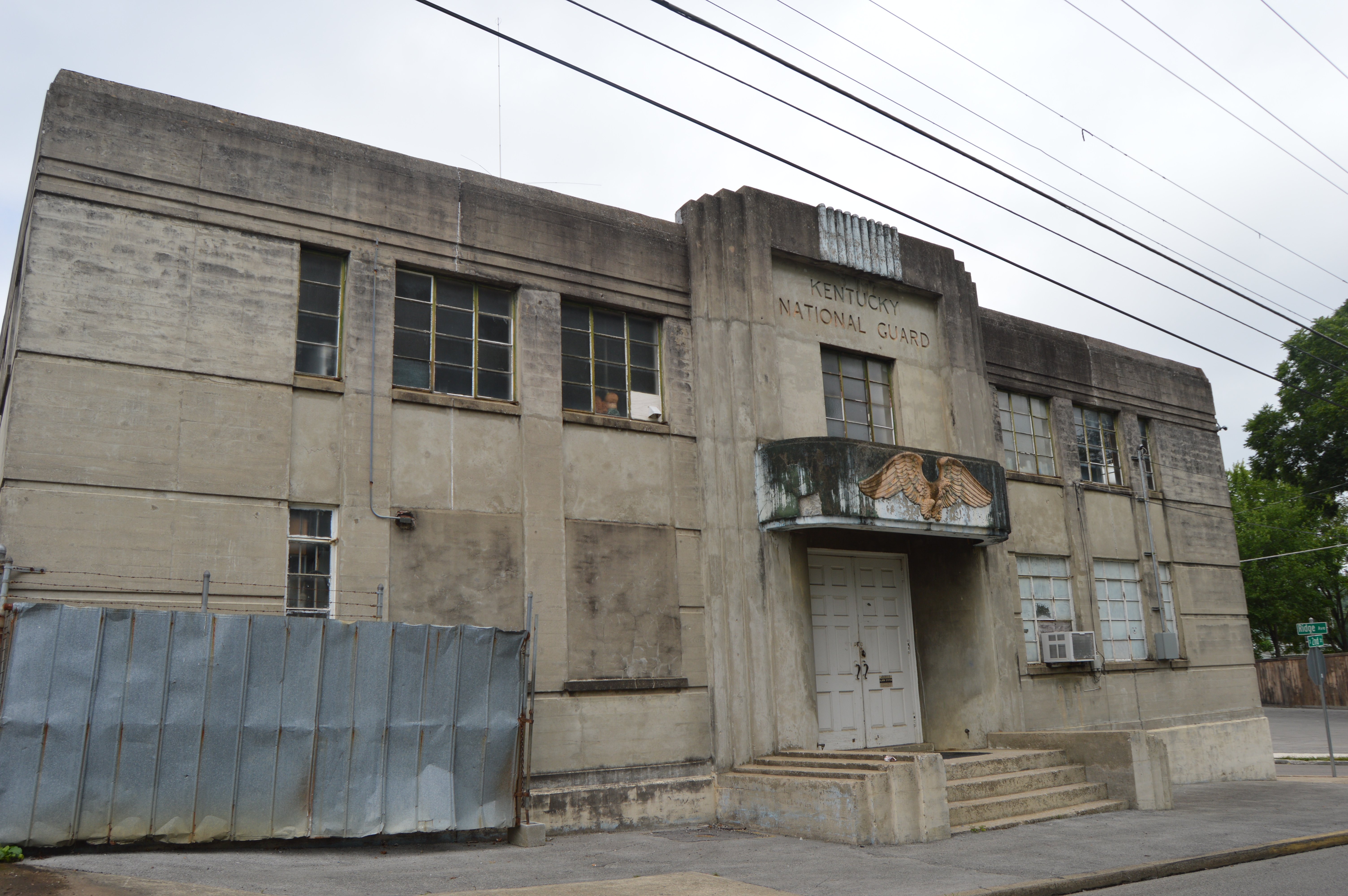
Williamsburg Armory
Front of the Williamsburg Armory, located on the western corner of the junction of Second and Ridge Streets in Williamsburg, Kentucky, United States. Built in 1941, it is listed on the National Register of Historic Places.
Wikimedia Commons (public domain)

Williamsburg Lane Theater
Front and eastern side of the Lane Theater, located at 510 Main Street (Kentucky Route 296) in Williamsburg, Kentucky, United States. Built in 1948, it is listed on the National Register of Historic Places.
Wikimedia Commons (public domain)