
Photo Gallery
Community photos and memories
No photos found.
Community Photos
Photos from local communities and photographers

Corps completes new paved setback levee in West Sacramento (14963245344)
Corps completes new paved setback levee in West Sacramento Ed Stewart (right), a construction representative with the U.S. Army Corps of Engineers Sacramento District, talks with University of California Davis professor Brett Milligan while touring a new paved setback levee near South River Road in West Sacramento, California, Oct. 15, 2014. The levee is part of the Sacramento River Bank Protection Project, a joint flood risk reduction effort between the Corps and the California Central Valley
Wikimedia Commons (public domain)

Mission Motel, 1 1-2 M. West of State Capitol, Highways 40 and 99 W. West Sacramento, Calif (81523)
Title: Mission Motel, 1 1/2 M. West of State Capitol, Highways 40 & 99 W. West Sacramento, Calif. Subjects: Motels Places: California > Yolo (county) > West Sacramento Notes: Title from item. Extent: 1 print (postcard) : linen texture, color ; 3 1/2 x 5 1/2 in. Accession #: 06_10_010283
Wikimedia Commons (public domain)
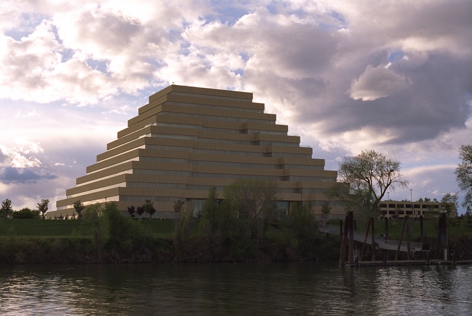
Sacramento-river-bank-pyramid-20.4
The Ziggurat — an office building in West Sacramento (Yolo County), viewed across the Sacramento River from the western edge of Sacramento. The headquarters of the California Department of General Services. Designed to resemble the ancient Mesopotamian ziggurats, the building was completed in 1997.
Wikimedia Commons (public domain)

West Sacramento levee road now open (16883475616)
A northern view March 20, 2015, of the U.S. Army Corps of Engineers Sacramento District’s completed setback levee, now functioning as South River Road in West Sacramento California. The work is part of the Sacramento River Bank Protection Project, a joint effort between the Corps and the California Central Valley Flood Protection Board to repair riverbank erosion along the Sacramento River and its tributaries. (U.S. Army photo by Todd Plain/Released)
Wikimedia Commons (public domain)

West Sacramento setback levee construction (6131507398)
Project manager Dave Cook (left) and construction representative Edward Stewart discuss the progress of setback levee construction Sept. 7 in West Sacramento as part of a joint effort between the U.S. Army Corps of Engineers and the Central Valley Flood Protection Board to upgrade levees along the Sacramento River and its tributaries. (U.S. Army Photo/Michael J. Nevins)
Wikimedia Commons (public domain)

West Sacramento setback levee construction (6131507898)
Crews construct the new setback levee Sept. 7 along South River Road in West Sacramento as part of a joint effort between the U.S. Army Corps of Engineers and the Central Valley Flood Protection Board to upgrade levees along the Sacramento River and its tributaries. (U.S. Army Photo/Michael J. Nevins)
Wikimedia Commons (public domain)