Earth MRI Case Studies Highlight Data Benefits
An official website of the United States government
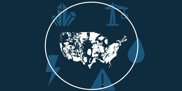
An official website of the United States government Official websites use .gov A .gov website belongs to an official government organization in the United States. Secure .gov websites use HTTPS A lock () or https:// means you’ve safely connected to the .gov website. Share sensitive information only on official, secure websites. New case studies highlight how stakeholders use and benefit from data and products generated by USGS Earth Mapping Resources Initiative (Earth MRI). Earth MRI is accelerating modern geological and geophysical mapping across the Nation. Through partnerships with State geological surveys, Federal agencies, Tribes, universities, and industry, Earth MRI applies advanced technologies to fill gaps in geologic knowledge. These new case studies, including videos, highlight how Earth MRI data are equipping the nation with the tools and information needed to grow stronger, smarter, and better prepared for tomorrow’s challenges. They were developed for the USGS by Tanaq Management Services, Abt Global, and Pinyon Environmental. Users rely on Earth MRI data for mineral exploration, land use planning, and research, and recognize its contributions to workforce development and national supply chain resilience. “There hasn't been a data collection effort like this since the 1970s...These are the data for the next 50 years and there’s so many different applications” - Geologist Industry, State geological surveys, and academic users highlighted the ability of Earth MRI data to accelerate project timelines, reduce exploration risk, and save costs (often hundreds of thousands to millions of dollars). “We’re just very glad this program came about. It makes a big difference to what we do. The US needed it.” - Mining Industry Geologist Graduate students, interns, and university researchers are beginning to leverage Earth MRI data for coursework, training, and funded projects. These opportunities help grow capacity in the geosciences. “Without Earth MRI we would not have these students working at all” ~ Economic Geologist within a university-affiliated State geological survey Studies in Australia and Canada have reported that Federal investments in basic geologic and geophysical datasets can yield increases of five-to-one or more in private sector economic activity. “It’s one of our key exploration datasets” - Mining Industry Geologist Explore case study snippets. Audio-descriptive videos available here (AD). The USGS Earth Mapping Resources Initiative (Earth MRI) is accelerating modern geological and geophysical mapping across the Western United States and the nation. The USGS Earth Mapping Resources Initiative (Earth MRI) is accelerating modern geological and geophysical mapping across the Western United States and the nation. The USGS Earth Mapping Resources Initiative (Earth MRI) is accelerating modern geological and geophysical mapping across the Eastern United States and the nation. The USGS Earth Mapping Resources Initiative (Earth MRI) is accelerating modern geological and geophysical mapping across the Eastern United States and the nation. The USGS Earth Mapping Resources Initiative (Earth MRI) is accelerating modern geological and geophysical mapping across Alaska and the nation. The USGS Earth Mapping Resources Initiative (Earth MRI) is accelerating modern geological and geophysical mapping across Alaska and the nation. Audio-descriptive videos available here (AD). The USGS Earth Mapping Resources Initiative (Earth MRI) is accelerating modern geological and geophysical mapping across the Western United States and the nation. The USGS Earth Mapping Resources Initiative (Earth MRI) is accelerating modern geological and geophysical mapping across the Western United States and the nation. The USGS Earth Mapping Resources Initiative (Earth MRI) is accelerating modern geological and geophysical mapping across the Eastern United States and the nation. The USGS Earth Mapping Resources Initiative (Earth MRI) is accelerating modern geological and geophysical mapping across the Eastern United States and the nation. The USGS Earth Mapping Resources Initiative (Earth MRI) is accelerating modern geological and geophysical mapping across Alaska and the nation. The USGS Earth Mapping Resources Initiative (Earth MRI) is accelerating modern geological and geophysical mapping across Alaska and the nation.