
Photo Gallery
Community photos and memories
No photos found.
Community Photos
Photos from local communities and photographers

John Cadwalader's grave
Gen. John Cadwalader's grave at Shrewsbury Chapel, Kent Co., Md.
Wikimedia Commons (public domain)
Tolchester folio Maryland Plate II
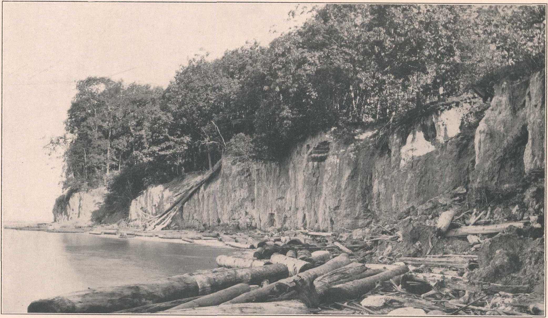
Plate II from Tolchester Folio, Maryland, which has the following caption: VERTICALLY JOINTED CLAY OF RARITAN FORMATION IN WAVE-CUT CLIFF, WORTON POINT, KENT COUNTY. The text of the publication states: The formation consists of diverse materials similar to those composing the Patapsco formation, except that, in general, the clays are not so highly colored. White and buff sands; stratified light chocolate-colored sandy clays, in places containing leaf impressions; light-colored argillaceous sand
Wikimedia Commons (public domain)

Tolchester folio Maryland Plate VI
Plate VI from Tolchester Folio, Maryland, which has the following caption: INDURATED FOSSILIFEROUS AQUIA FORMATION ON CHESTER RIVER, 2 1/2 MILES BELOW CHESTERTOWN, KENT COUNTY. Contains casts of large mollusks of Eocene age. The text of the Folio states: Character. The formation consists ordinarily of loose sand containing considerable glauconite, which in places makes up the body of the formation. Where the material is fresh its color ranges from light blue to dark green, but where it has been
Wikimedia Commons (public domain)

Tolchester folio Maryland Plate VII
Plate VII from Tolchester Folio, Maryland, which has the following caption: CONGLOMERATE IN WICOMICO FORMATION, NEAR BETTERTON, KENT COUNTY. The Wicomico formation extends below sea level at this point. The text of the Folio states: The materials which compose the (Wicomico) formation are clay, sand, gravel, and ice-borne boulders. As explained above, these materials do not lie in well-defined beds but grade into one another both vertically and horizontally. The coarser deposits have in the mai
Wikimedia Commons (public domain)
Tolchester folio Maryland Plate VIII
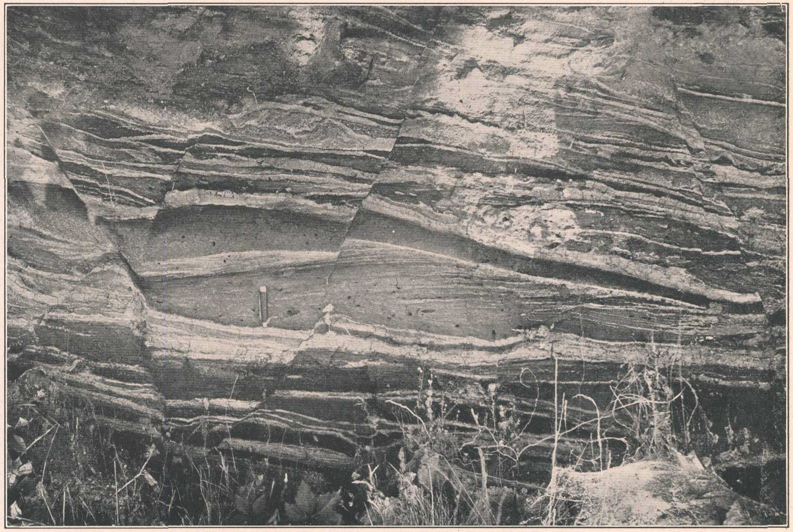
Plate VIII from Tolchester Folio, Maryland, which has the following caption: RECENT MINOR FAULTING OF INTERBEDDED CLAY AND SAND OF TALBOT FORMATION ON MORGAN CREEK, KENT COUNTY. The text of the Folio states: The geologic structure of the Coastal Plain part of the Tolchester quadrangle is simple, the beds having suffered little deformation since their deposition. Folds of the strata are almost if not entirely lacking, and faults have been observed at only one place in the quadrangle. In the righ
Wikimedia Commons (public domain)

Tolchester folio Maryland Plate X
Plate X from Tolchester Folio, Maryland, which has the following caption: SAND SPIT THAT FORMS BAR ACROSS MOUTH OF LLOYD CREEK, KENT COUNTY. View looking west from top of cliff opposite mouth of creek. The text of the Folio states: Minor streams. The estuaries that form so prominent a feature receive the waters of numerous minor streams. At the head of each estuary there is a small stream, which is almost invariably much shorter than the estuary itself. Some of the smaller estuaries, particular
Wikimedia Commons (public domain)

Vertically jointed clay of Raritan formation dnh00206
Full frame of photo used in Plate II from Tolchester Folio, Maryland, which has the following caption: VERTICALLY JOINTED CLAY OF RARITAN FORMATION IN WAVE-CUT CLIFF, WORTON POINT, KENT COUNTY. The text of the publication states: The formation consists of diverse materials similar to those composing the Patapsco formation, except that, in general, the clays are not so highly colored. White and buff sands; stratified light chocolate-colored sandy clays, in places containing leaf impressions; lig
Wikimedia Commons (public domain)