
Photo Gallery
Community photos and memories
No photos found.
Community Photos
Photos from local communities and photographers

Lehigh Valley, 1880
1880 illustration of Lehigh Valley and Mauch Chunk.
Wikimedia Commons (public domain)

Jim Thorpe PA A Packer House to St Marks
Overview of downtown Jim Thorpe, Carbon County, Pennsylvania. View is of St. Mark's Episcopal Church on the SE side of downtown from the park by the Asa Packer Mansion on the other side.
Wikimedia Commons (cc0)

Jim Thorpe PA Stone Row
Stone Row in Jim Thorpe, Pennsylvania
Wikimedia Commons (cc0)

RC Church Mauch Chunk PA
A photograph (postcard) of the Catholic Church at Mauch Chunk, Pennsylvania
Wikimedia Commons (public domain)

Schuylkill-Lehigh River Drainage Divides USGS, Hazelton-Mauch Chunk & Mountain Quads, NW+NE-4
This is a sufficiently detailed derivative work of two 19th Century USGS maps as reprinted in the 1930s with annotations showing Watersheds (by any cultural definition). • The map is centered on the three parallel ridges that run SW-to-NE but pinch down and converge into a steep valley along the Lehigh Valley in the stretch (N+W-to-S+E) Nesquehoning, Jim Thorpe (formerly Mauch Chunk, and Lehighton in the middle Lehigh Valley. • That is showing several topological Geological features, mainly Ma
Wikimedia Commons (public domain)

Tomb of Jim Thorpe b
Jim Thorpe's grave in Jim Thorpe, Pennsylvania
Wikimedia Commons (cc0)
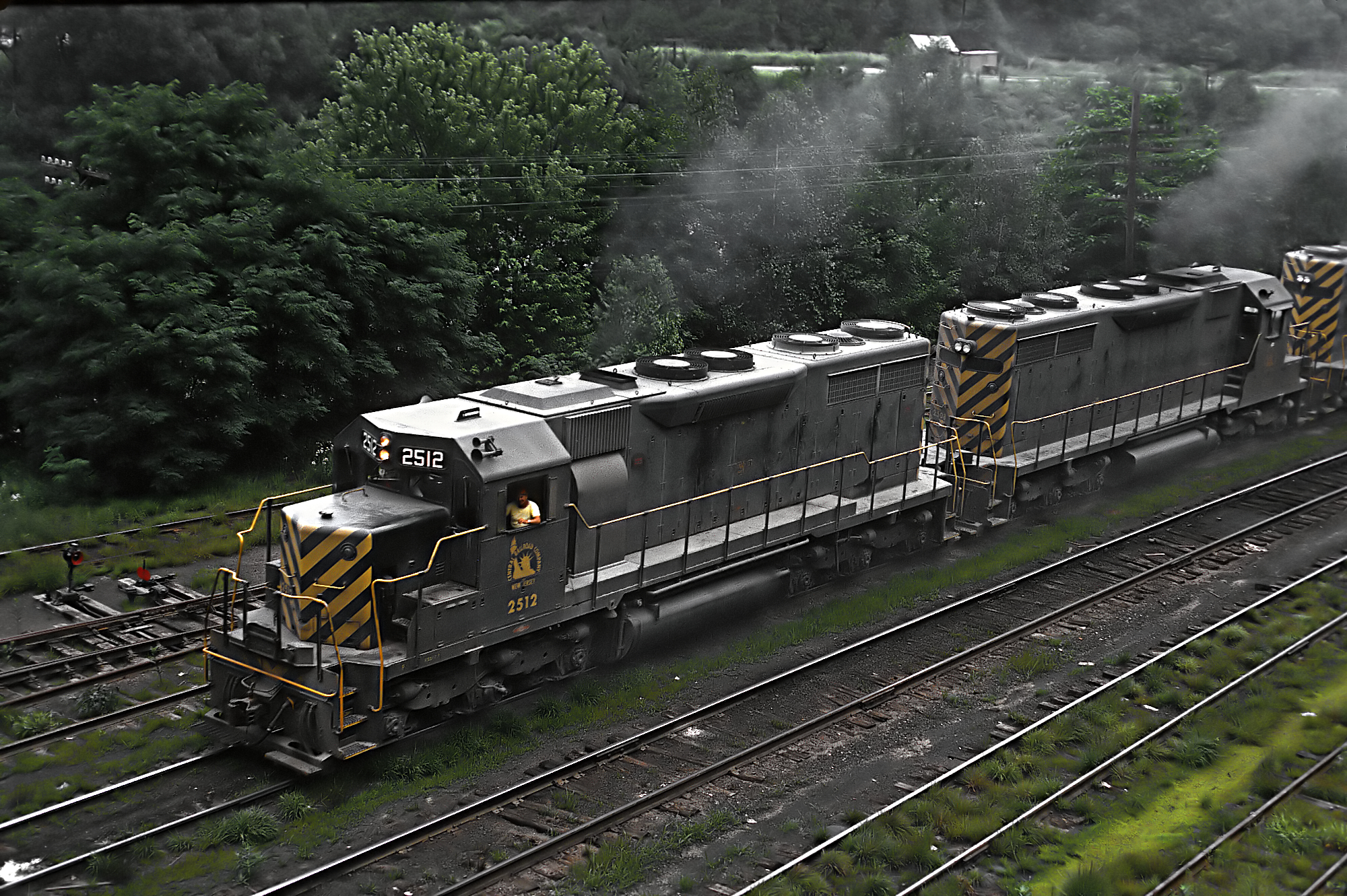
CNJ SD35 2512 at Jim Thrope, PA on July 12, 1970 02 (24160277741)
A Roger Puta photograph.
Wikimedia Commons (public domain)

Central Railroad of New Jersey SW9 1093 at Jim Thrope, PA on Julyt 12, 1970 (23913434399)
A Roger Puta Photograph
Wikimedia Commons (public domain)

Central of New Jersey 1544 (RS3) at Jim Thrope, PA on July 12, 1970 (22340974028)
Photo by Roger Puta
Wikimedia Commons (public domain)

Dimmick Memorial Library Jim Thorpe PA 1889 (cropped)
Dimmick Memorial Library, Jim Thorpe, Carbon County, Pennsylvania (1889), Thomas Roney Williamson, architect. This photo was taken soon after the December 13, 1979 fire.
Wikimedia Commons (public domain)
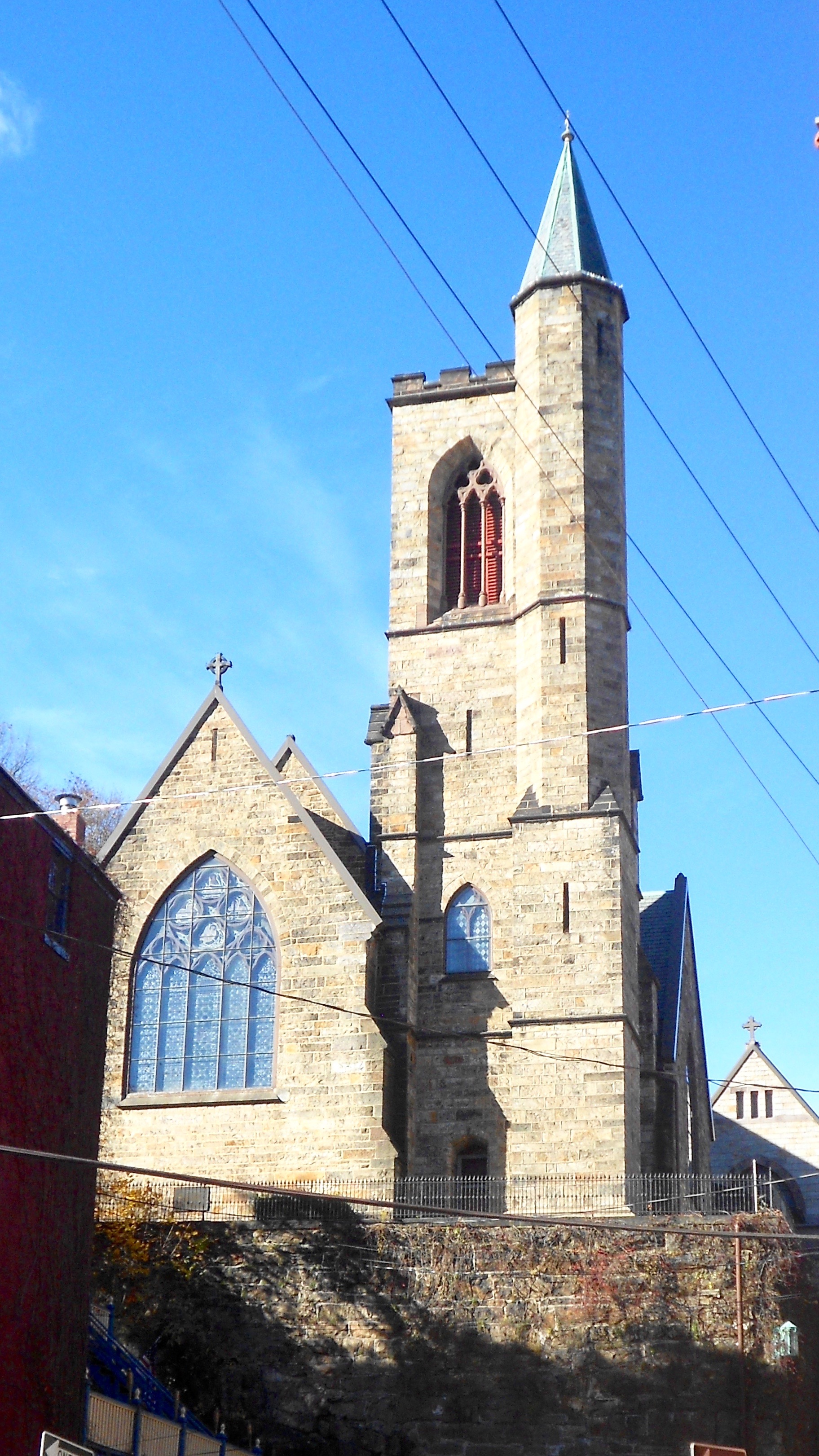
Jim Thorpe PA St Marks Episcopal
St. Mark's Church in Jim Thorpe, Pennsylvania
Wikimedia Commons (cc0)

Jim Thorpe Skyline
A view from the Switchback Railroad Trail that highlights the St. Mark’s and St. John’s Episcopal Church
Wikimedia Commons (cc0)

Karl Bodmer Travels in America (5)
'Aquatint' by Karl Bodmer (1809 - 1893). See: category:Lehigh River This is a view of the Lehigh River south-southeasterly across the so called 'slack water pool' above the lower Lehigh Canal as viewed from the shoreline of East Mauch Chunk* located between Mauch Chunk, (Pennsylvania (Now Jim Thorpe, PA) and upstream Nesquehoning, PA in Carbon County, Pennsylvania. Depicted is the coal barge loading docks and chute terminating the Summit Hill & Mauch Chunk Railroad, which existed over 111 ye
Wikimedia Commons (public domain)

G640075-1947updt1983-1, Quad=Lehighton, PA Bear Mountain+Jim Thorpe,PA+Lehigh Gap+Mount Pisgah
This map shows the Lehigh Water Gap between Bear_Mountain on the east bank Lehigh Canal and Jim Thorpe, PA in the shadow of Mount Pisgah a the end of Pisgah Mountain (Pisgah Ridge)..
Wikimedia Commons (public domain)