
Photo Gallery
Community photos and memories
No photos found.
Community Photos
Photos from local communities and photographers

East Tennessee Crossing - Ribbon Cutting at the East Tennessee Crossing - NARA - 7718112
Scope and content: The original finding aid described this photograph as: Original Caption: Officials from the counties along the East Tennessee Crossing attend the official ribbon cutting ceremony on April 30, 2010. Location: Clinch Mountain, Tennessee (36.350° N 83.394° W) Status: Public domain. Public Domain
Wikimedia Commons (public domain)

East Tennessee Crossing - Rolling Hills of the Crossing - NARA - 7718102
Scope and content: The original finding aid described this photograph as: Original Caption: Green, forested mountain folds of the Great Tennessee Valley extend into the distance toward the Great Smoky Mountains. Green hills roll like waves into the background, growing more blue with each ridge fading into the distance. Location: Great Tennessee Valley, Tennessee (36.351° N 83.398° W) Status: Public domain. Photo by Ann Cason
Wikimedia Commons (public domain)

East Tennessee Crossing - The East Tennessee Crossing Meeting Clinch Mountain - NARA - 7718111
Scope and content: The original finding aid described this photograph as: Original Caption: The East Tennessee Crossing descends down Clinch Mountain, following close to the path of the original Wilderness Road and the Warriors Path. The byway is surrounded by the reds, golds, yellows and greens of full fall foliage, accented by the folding hollows of War Ridge and Powell Mountain in the background. Location: Tennessee (36.353° N 83.403° W) Status: Public domain. Photo by Michael Sledjeski
Wikimedia Commons (public domain)

East Tennessee Crossing - View from Atop Clinch Mountain - NARA - 7718104
Scope and content: The original finding aid described this photograph as: Original Caption: From high atop Clinch Mountain and the winding shorelines of Cherokee Lake, travelers can find a long, serene view of the broad valley with extensive lakes stretching in all directions. This was the route and landscape through which passed the East Tennessee Crossing Byway — the Warriors Path, the Wilderness Road and the Dixie Highway. Location: Tennessee (36.350° N 83.394° W) Status: Public domain. Ph
Wikimedia Commons (public domain)

Tate Spring Hotel - NARA - 281360
Wikimedia Commons (public domain)

Tate Springs Hotel - NARA - 281456
Wikimedia Commons (public domain)
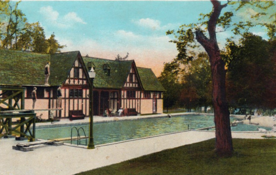
Tate Springs pool - bathhouse
The swimming pool and bathhouse of the Tate Springs resort complex, constructed in early 1924, with picture taken in the same year.
Wikimedia Commons (public domain)