Photo Gallery
Community photos and memories
No photos found.
Community Photos
Photos from local communities and photographers

A boy clapping (Unsplash)
Fayetteville, United States
Wikimedia Commons (cc0)

Among The Trees (Unsplash)
Fayetteville, United States
Wikimedia Commons (cc0)

Fayetteville, Arkansas circa 1887
A circa 1887 view of Fayetteville, Arkansas
Wikimedia Commons (public domain)

Fayetteville Farmer's Market
Fayetteville Farmer's Market on the Fayetteville Historic Square with the Old Bank of Fayetteville Building, Lewis Brothers Building, and Mrs. Young Building all visible in the background.
Wikimedia Commons (public domain)

I-540 and US 71 run in Fayetteville
This is I-540 and US 71 curving into the Ozark Mountains in the Fayetteville, Arkansas city limits. This image is taken from the Wedington Drive overpass facing south.
Wikimedia Commons (cc0)

Kentucky at Arkansas Men's basketball 2023
University of Kentucky at University of Arkansas Men's basketball game in Bud Walton Arena 2022-23 season
Wikimedia Commons (cc0)

Arkansas 180
Arkansas Highway 180 eastbound after its intersection with AR 112 in Fayetteville
Wikimedia Commons (cc0)

Arkansas Highway 16 in west Fayetteville
Arkansas Highway 16 in west Fayetteville.
Wikimedia Commons (cc0)

Clear Creek in Fayetteville, Arkansas
Clear Creek runs over a rocky streambed shortly after discharging from the Lake Fayetteville dam. Photo taken from the Razorback Regional Greenway bridge
Wikimedia Commons (cc0)

End U.S. Route 62 S 1
This little sign in Fayetteville, AR indicates the end of U.S. Route 62, section 1. The route travels 24.65 miles from the Oklahoma state line and terminates at Shiloh Drive, which is the off ramp of I-540 southbound. U.S. 62 segment two begins in Benton County at I-540 exit 86. The route has 21 separate sections in the state.
Wikimedia Commons (public domain)

Fayetteville, AR from I-49
Fayetteville, Arkansas from I-49 northbound. Buildings from left: Reid Hall, Maple Hill dormitories, Donald W. Reynolds Razorback Stadium, Hotz Hall, Barnhill Arena, Arkansas Union, Bud Walton Arena, Gibson Hall, Pomfret Hall, Humphrey Hall, Yocum Hall, Discovery Hall, Willard J. Walker Hall, Old Main, The Vue apartments
Wikimedia Commons (cc0)

Fayetteville, Arkansas police car
A Fayetteville Police Department car parked at the Walmart Neighborhood Market on MLK Jr Blvd in Fayetteville, AR, the weekend after the Walmart shooting in El Paso
Wikimedia Commons (cc0)

Fayetteville, United States (Unsplash AaIOFaVjmbI)
Fayetteville, United States
Wikimedia Commons (cc0)

Fayetteville, United States (Unsplash RMW9C9MtDoQ)
Fayetteville, United States
Wikimedia Commons (cc0)

Fayetteville FYV
Drake Field in Fayetteville, AR
Wikimedia Commons (public domain)

Fayettevillelibrary
The Fayetteville Public Library, opened in October 2004, winner of the 2005 Best Library of the Year award.
Wikimedia Commons (public domain)

Garland Avenue in Fayetteville, AR
Garland Avenue in Fayetteville, AR. This road is also named Arkansas Highway 112. This picture is facing southwest. Buildings in the background include the Pat Walker Health Center and Northwest Quad Building B.
Wikimedia Commons (public domain)

Greenland, United States (Unsplash 53MGRMihypQ)
Greenland, United States
Wikimedia Commons (cc0)

Happy To Be Alone (Unsplash)
Westwood Gardens, Fayetteville, United States
Wikimedia Commons (cc0)

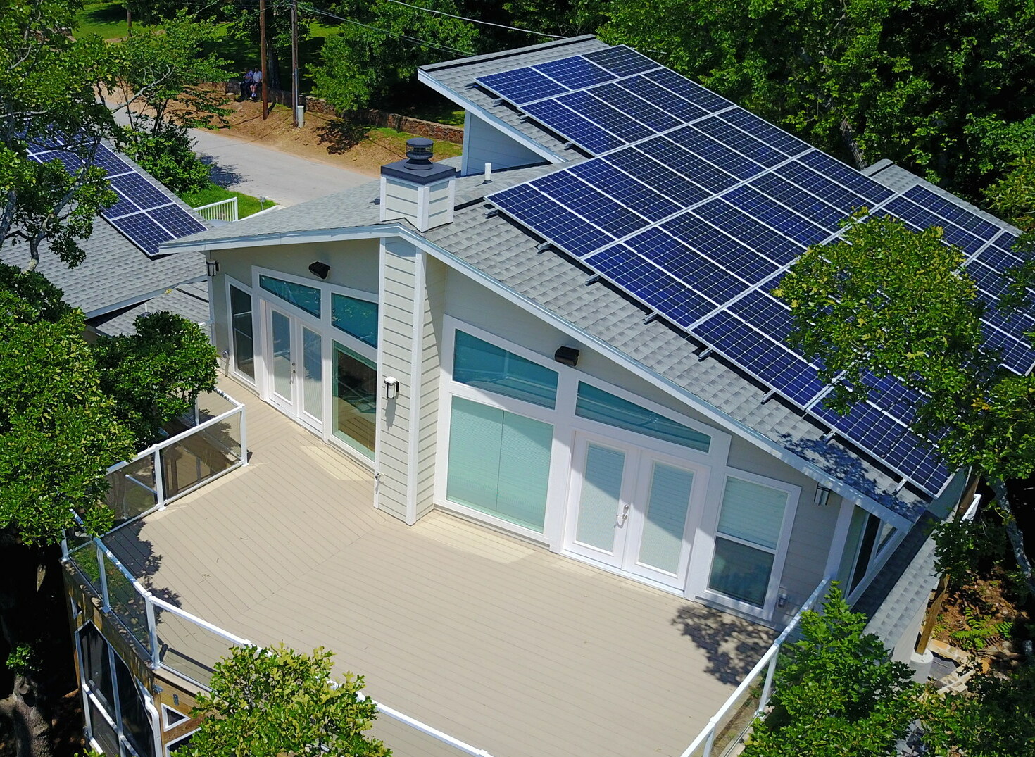
Hutchings 000379 166330 510821 4578 (36792953352)
Solar Home in Ozarks. Fayetteville, Arkansas
Wikimedia Commons (public domain)
Hutchings 000379 166330 510821 4578 (36792953352) (cropped)
Solar Home in Ozarks. Fayetteville, Arkansas
Wikimedia Commons (public domain)

It's cold out here (Unsplash)
Botanical Garden of the Ozarks, Fayetteville, United States
Wikimedia Commons (cc0)

Return to Home