
Photo Gallery
Community photos and memories
No photos found.
Community Photos
Photos from local communities and photographers

Downtown Zanesville, OH
Downtown Zanesville, OH
Photo by Chris Bischoff on Unsplash

Birmingham, AL
Birmingham, AL
Photo by Kalei de Leon on Unsplash

Downtown ST Paul MN, LANMARK CENTER
Downtown ST Paul MN, LANMARK CENTER
Photo by Javier Quiroga on Unsplash

Aerial shot of Downtown Fort Wayne, Indiana.
Aerial shot of Downtown Fort Wayne, Indiana.
Photo by TopSphere Media on Unsplash

Downtown Evansville, Indiana (2nd & Main Streets)
Downtown Evansville, Indiana (2nd & Main Streets)
Photo by Abby Elpers on Unsplash
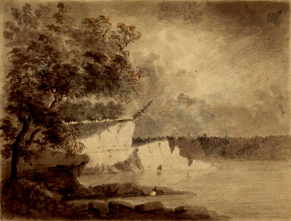
Wabash River - Henry Hamilton 1778
Landscape sketched during Henry Hamilton's tavel down the Wabash River to recapture the village of Vincennes.
Wikimedia Commons (public domain)
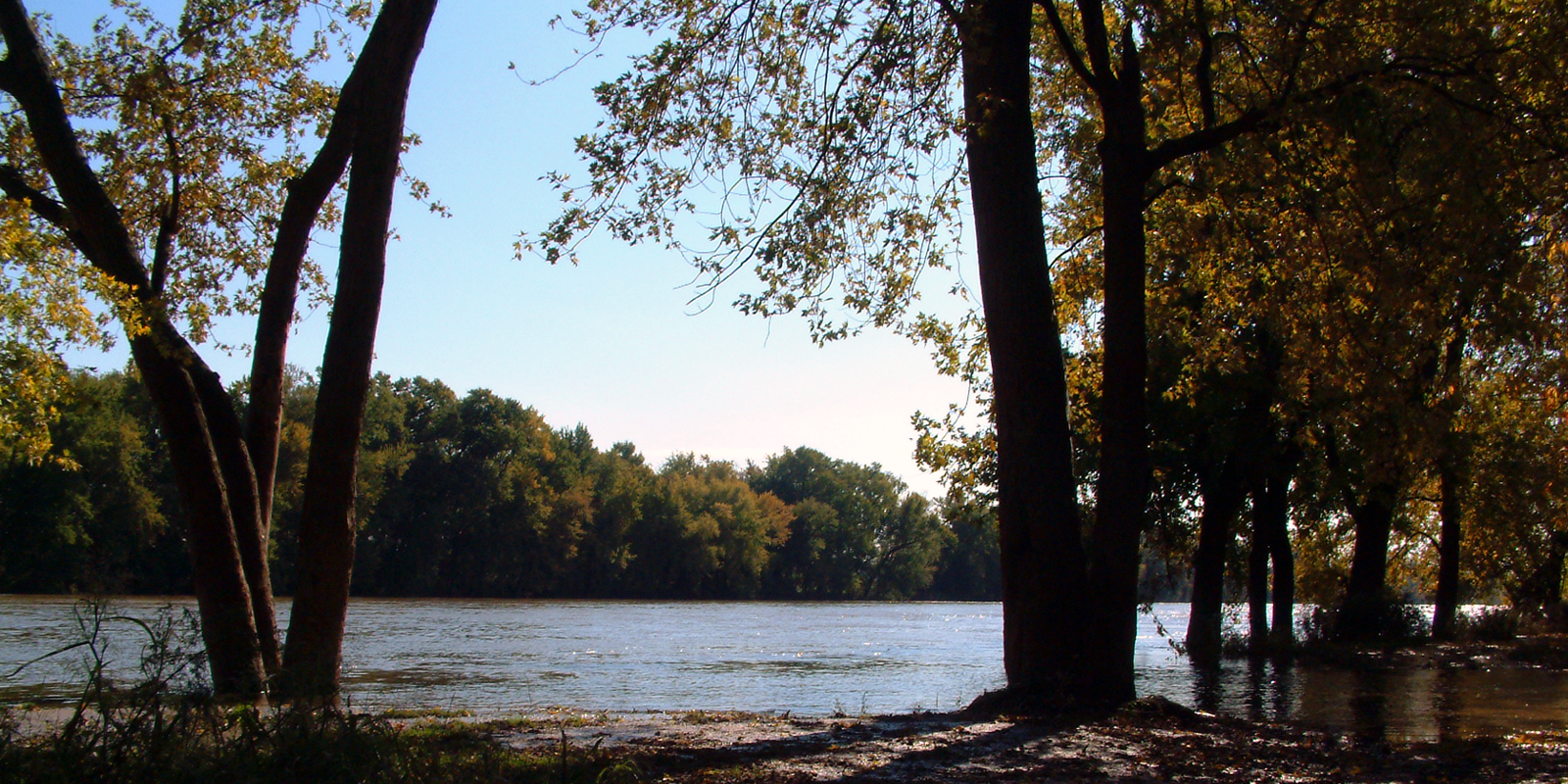
Wabash River at Williamsport
The Wabash River at Williamsport, Indiana. This photo looks south-southeast toward the Fountain County side of the river, and was taken from the shore in Williamsport's "Old Town" near the end of East Washington Street.
Wikimedia Commons (public domain)

Wabash River historical marker
Sign for the beginning of the Wabash river.
Wikimedia Commons (cc0)

Wabash inlet and island
Seen from Indiana, just across the river from Mt. Carmel, this inlet and island are a wildlife preserve established just a few yards from the campus of the Gibson Generating Station.
Wikimedia Commons (public domain)
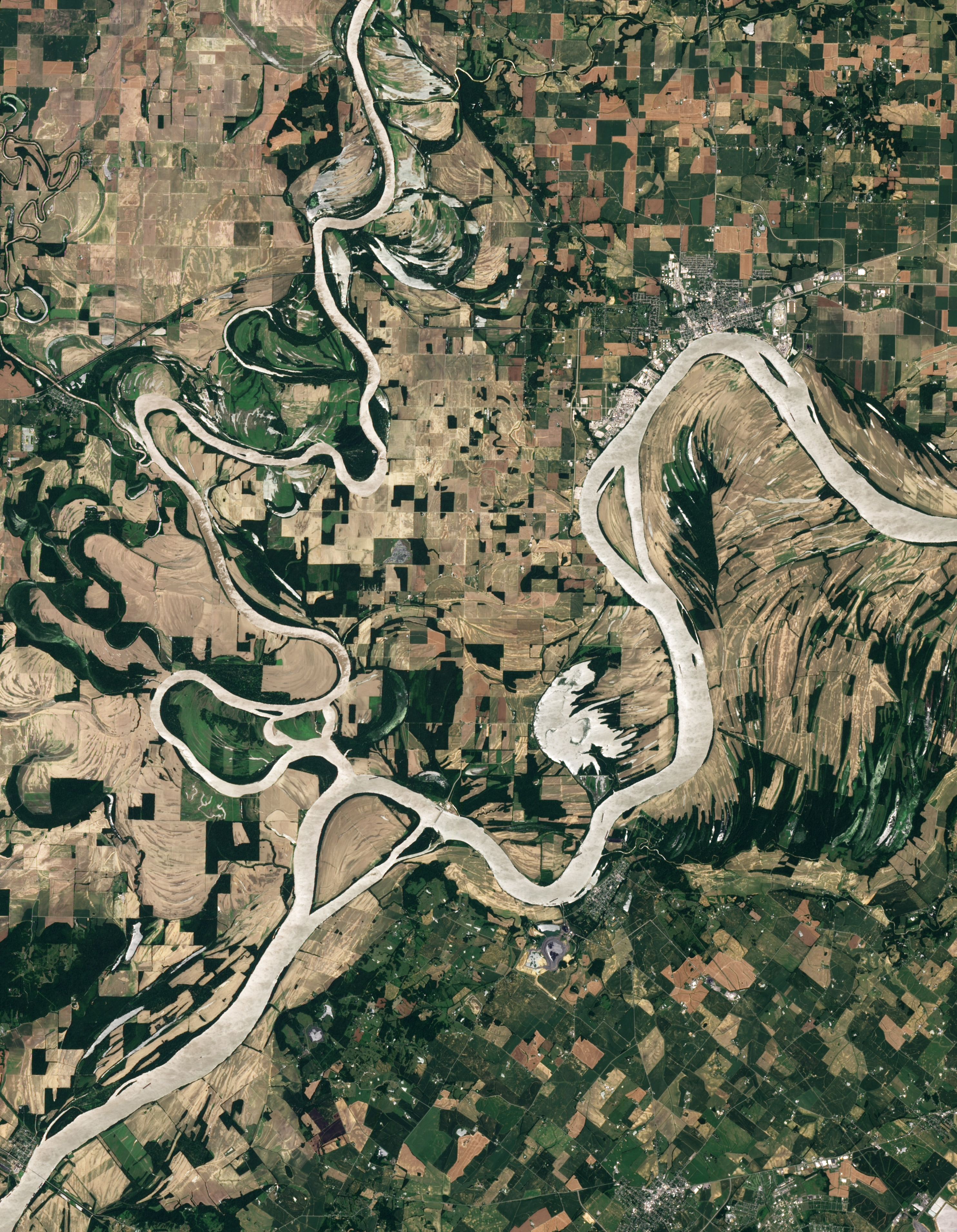
Floods Recede around the Wabash-Ohio Confluence
Natural-colour image of the Wabash-Ohio confluence. Both rivers, as well as Hovey Lake, appear silver-grey in this image, probably due to the reflection of sunlight off the water surface (sunglint). Away from the water, the land is a patchwork of croplands shaped by human design, and floodplains shaped by overflowing rivers.
Wikimedia Commons (public domain)

Forks of the Wabash
Surface-level view of the Forks of the Wabash: the confluence of the Wabash River (right) with the Little Wabash River (left), at the western edge of Huntington, Indiana, United States. Picture looks eastward from the riverbank under the bridge carrying State Road 9 over the Wabash. The site is part of the historic district known as the Chief Richardville House and Miami Treaty Grounds, which is listed on the National Register of Historic Places.
Wikimedia Commons (public domain)

Sunset Point near Delphi
Overview of Sunset Point, located at the confluence of Deer Creek and the Wabash River just southwest of Delphi, Indiana, United States. Besides being a scenic location, it was the spot of significant activity along the Wabash and Erie Canal, and it is an archaeological site. As such, it is listed on the National Register of Historic Places.
Wikimedia Commons (public domain)

Wabash River
The w:Wabash River at w:Covington, Indiana
Wikimedia Commons (public domain)