
Photo Gallery
Community photos and memories
No photos found.
Community Photos
Photos from local communities and photographers

Allegany Museum, Cumberland, Maryland, USA
Allegany Museum, Cumberland, Maryland, USA
Wikimedia Commons (cc0)

5 of Roger Puta's Photos of the Baltimore and Ohio (27614945402)
B&O 1449 (E8A) at Cumberland, MD Shops on December 5, 1970.
Wikimedia Commons (public domain)

6 Shots of the B&O Capitol Limited by Roger Puta (27085361534)
B&O observation lounge Wawasee with drumhead on the westbound commemorative run of Train 5, The Capitol Limited, at Cumberland, MD on April 29, 1971.
Wikimedia Commons (public domain)

America's Highways 1776–1976 - Old Cumberland Road at Wills Creek
Old Cumberland Road at Wills Creek just west of Cumberland, Md.
Wikimedia Commons (public domain)

B&O West Virginian at Cumberland, May 1969 (27689654636)
B&O 1449 (E8A) train #32, the eastbound West Virginian, arriving at Cumberland, Maryland on May 17, 1969. The Parkersburg-Washington West Virginian (which used a name retired in 1962) was the sole remaining part of the National Limited after January 26, 1968.
Wikimedia Commons (public domain)

Bird's Eye View of Cumberland, Maryland 1906 WDL11374
This panoramic map shows Cumberland, Maryland, as it appeared in 1906. Located on the Potomac River in the western part of the state, Cumberland was an important transportation hub early in the nation’s history. It was the western terminus of the Chesapeake and Ohio Canal, built between 1828 and 1850 to link the Ohio River with Chesapeake Bay. It was the starting point of the National Road (also known as the Cumberland Road), on which construction began in 1811, and which ran westward to Vandali
Wikimedia Commons (public domain)

Canal Place Field, Cumberland MD
Canal place field, Cumberland Md. (Canal and guard lock 8 are to the left)
Wikimedia Commons (cc0)

Canal Place museum at Cumberland MD
Museum (Former Western MD Railroad Station) brick building in background, at Canal Place, Cumberland, MD
Wikimedia Commons (cc0)

Cumberland, Maryland, Circa 1865 (50512715098)
Cumberland, Maryland, Circa 1865
Wikimedia Commons (public domain)
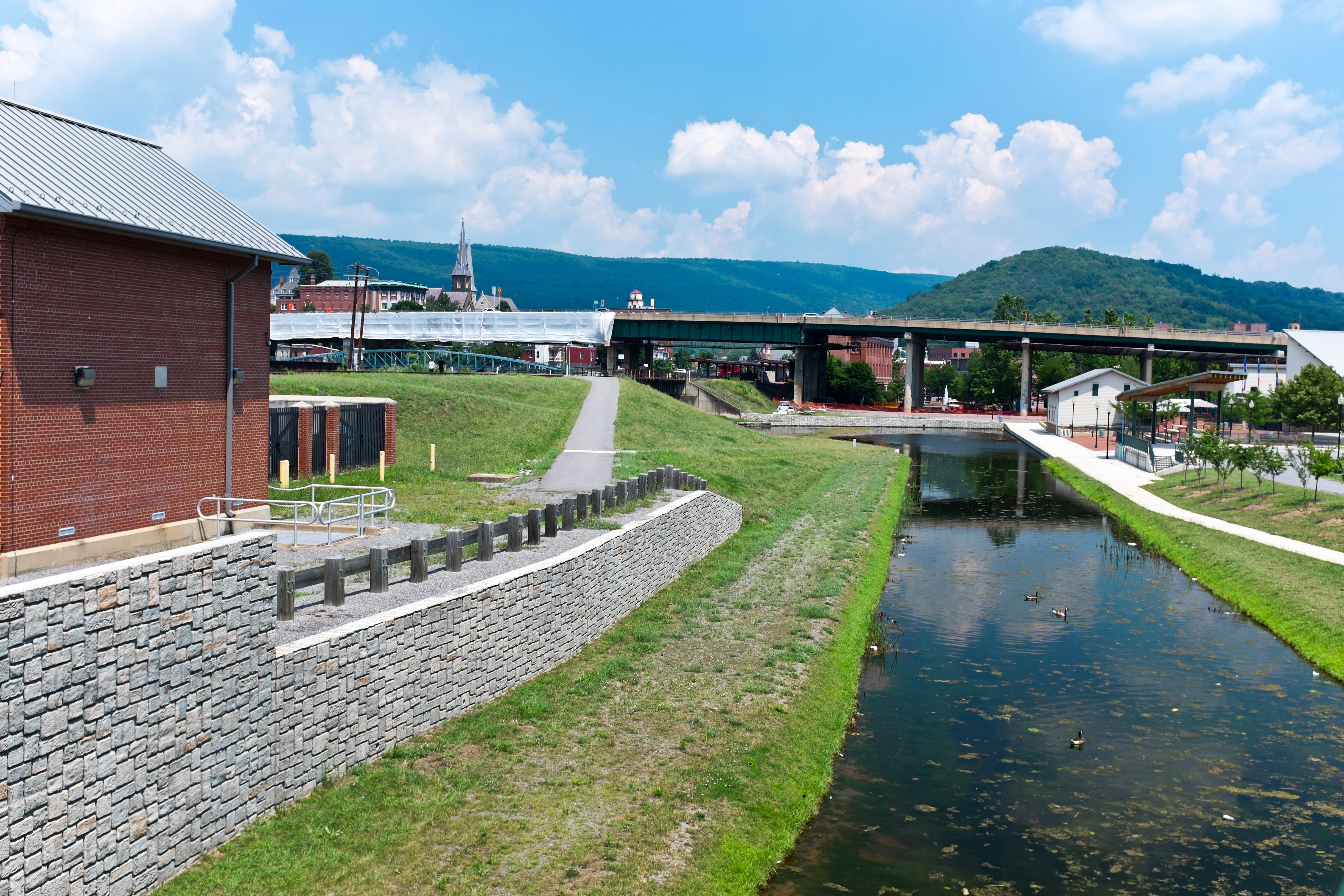
Cumberland Basin looking North
This is the basin at the end of the Chesapeake and Ohio Canal, looking north toward the end of the canal. Guard lock #8 is at the end of the channel on the left. Interstate Highway 68 / US 40 / US 220 runs on that bridge in the background. The Cumberland Masonic Temple and the Emmanuel Episcopal Church are visible to the left, beyond the highway bridge. The Western Maryland Station is just visiable (brick building, center of picture) beyond the highway bridge. Shops at Canal Place are to the rig
Wikimedia Commons (cc0)

Cumberland MD C&O Canal-coal loading
"Canal boats at Cumberland, Maryland, being loaded from railroad cars. The boats riding low in the water have already been loaded. National Park Service: E.B. Thompson Historic Negative Collection." Western terminus of the Chesapeake and Ohio Canal. Seen in the photo are coal cars from the Consolidation Coal Company and the Cumberland and Pennsylvania Railroad.
Wikimedia Commons (public domain)

Cumberland Narrows air
Oblique air photo of Cumberland Narrows (a water gap), facing northeast, December 10, 2006. Wills Mountain is at top, Haystack Mountain (Maryland) is at bottom. The anticlinal structure of the Tuscarora Formation (sandstone layer at top and sides of the mountain) is apparent in this photo. w:U.S. Route 40 Alternate and the National Road & historic Cumberland Road runs through the pass from and above w:Cumberland, Maryland, as did the historic Baltimore and Ohio Railroad's tracks to the Monon
Wikimedia Commons (public domain)

Del McCoury Band Delfest 2009
Del McCoury Band at 2nd annual DelFest, May 22, 2009 (Friday night set). Left to right: Jason Carter (fiddle), Ronnie McCoury (mandolin), Robbie McCoury (banjo), Alan Bartram (bass), Del McCoury (guitar).
Wikimedia Commons (public domain)

Entrance to Canal Place Shops at Cumberland MD
Entrance, going to the shops at Canal Place, Cumberland MD
Wikimedia Commons (cc0)

Maryland - Cumberland - NARA - 23940917
Wikimedia Commons (public domain)

Maryland - Cumberland - NARA - 23940919
Wikimedia Commons (public domain)

Maryland - Cumberland - NARA - 23940919 (cropped)
Wikimedia Commons (public domain)

Meanders Potomac Paw Paw air
Air photo of meanders in the Potomac River with Paw Paw, West Virginia just above center. Facing south, Jan. 17, 2009. Color enhanced in Photoshop.
Wikimedia Commons (public domain)
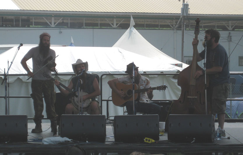
Mountain Sprout DelFest 2012
Mountain Sprout (bluegrass band) playing at 5th annual DelFest at Allegany County Fairgrounds, Maryland on May 27, 2012.
Wikimedia Commons (cc0)

Mountain inn
Wills Mountain Inn, Cumberland, Maryland
Wikimedia Commons (public domain)

Participants run during the 12th Annual Tom's Run -b
BALTIMORE – Two participants of the Tom’s Run, a 200-mile relay held in memory of Coast Guard Chief Warrant Officer Tom Brooks, travel down the Chesapeake and Ohio Canal to meet their team members at the next check point of the journey, June 4, 2010. The event starts in Cumberland, Md., at midnight and runs throughout continuously until teams reach their destination in Bethesda, Md. U.S. Coast Guard photo by Petty Officer 3rd Class Robert Brazzell. Note: This looks like the camera was on top of
Wikimedia Commons (public domain)

Queen city hotel menu 1884
Wikimedia Commons (public domain)

Thomas Koon House Mar 11
Thomas Koon House, Cumberland, Maryland
Wikimedia Commons (public domain)