
Photo Gallery
Community photos and memories
No photos found.
Community Photos
Photos from local communities and photographers

1876 Clarksville Chronicle advert Tennessee
Advertisement for Clarksville Chronicle newspaper, Tennessee, USA [1]
Wikimedia Commons (public domain)

Burt High School
Burt High School (1923–1952) in Clarksville, Tennessee
Wikimedia Commons (public domain)

Clarksville022
Clarksville Courthouse
Wikimedia Commons (public domain)

Clarksville Greenway, Clarksville, United States (Unsplash)
Clarksville Greenway, Clarksville, United States
Wikimedia Commons (cc0)

Clarksville Methodist Church former building
Front and western side of the former Clarksville Methodist Church (now a residence), located at 334 E. Main Street in Clarksville, Tennessee, United States. Built in 1831, it is listed on the National Register of Historic Places.
Wikimedia Commons (public domain)
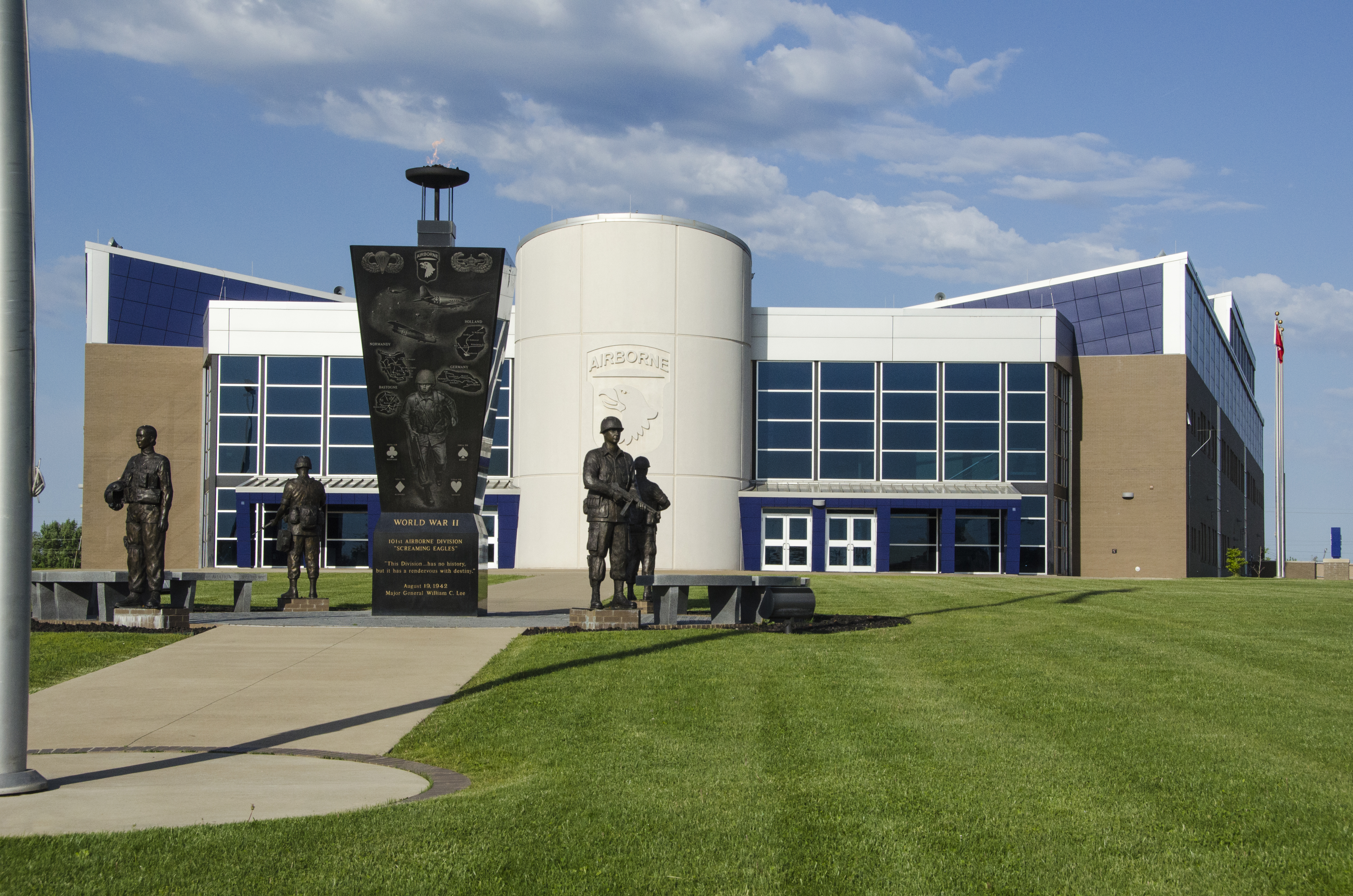
Command and control facility of 101st Airborne Division, Fort Campbell, Kentucky
Command and control facility of 101st Airborne Division, Fort Campbell, Kentucky.
Wikimedia Commons (public domain)

Emerald Hill in Clarksville
Looking east from Second Street (U.S. Route 41/State Route 76) toward the campus of Austin Peay State University in Clarksville, Tennessee, United States. The building in the distance is the Emerald Hill mansion; built in 1830, it is listed on the National Register of Historic Places.
Wikimedia Commons (public domain)

FEMA - 44082 - Clarksville neightborhood flooding in Tennessee
Clarksville, TN, May 12, 2010 -- A Clarksville neighborhood remains flooded more than a week after the storms due to the unusual topography which collected more than four feet of run-off water and flooded many homes in the area. FEMA is responding to severe storms and flooding that damaged or destroyed thousands of homes across Tennessee in May 2010. FEMA/David Fine
Wikimedia Commons (public domain)

FEMA - 44084 - Resident of Clarksville surveying her flood damaged home
Clarksville, TN, May 12, 2010 -- Dena Hollin of Clarksville surveys the flood damage to her home as they continue to wait for flood waters to recede more than a week after the storms due to the unusual typography which collected more than four feet of run-off water and flooded many homes in the area. FEMA is responding to severe storms and flooding that damaged or destroyed thousands of homes across Tennessee in May 2010. FEMA/David Fine
Wikimedia Commons (public domain)

FEMA - 44085 - Flooding in Clarksville
Clarksville, TN, May 12, 2010 -- A Clarksville neighborhood remains flooded more than a week after the storms due to the unusual typography which collected more than four feet of run-off water and flooded many homes in the area. FEMA is responding to severe storms and flooding that damaged or destroyed thousands of homes across Tennessee in May 2010. FEMA/David Fine
Wikimedia Commons (public domain)

Home Infirmary Site
This hill was the former site of the Home Infirmary in Clarksville, TN. The Home Infirmary was the first hospital in the city being established in 1906. Formerly listed on the NRHP, it was burned down by arson in 1992.
Wikimedia Commons (cc0)

Old Post House
Front and southern end of the Old Post House, located in the median between the northbound and southbound lanes of U.S. Route 41 near Fort Campbell in northern Clarksville, Tennessee, United States. Built in 1830 as a post office, it is listed on the National Register of Historic Places.
Wikimedia Commons (public domain)

Robert T. Burt
Dr. Robert T. Burt (1873–1955)
Wikimedia Commons (public domain)

Sullivan below Washington in Clarksville
Buildings on the eastern side of Sullivan Street south of the Washington Street intersection in Clarksville, Tennessee, United States. This neighborhood is part of the Clarksville Industrial District, a historic district that is listed on the National Register of Historic Places.
Wikimedia Commons (public domain)

U.S. Route 79 North of Clarksville, Tennessee
This is a view looking northbound on U.S. Route 79. The location is about one mile north of the junction with Interstate 24 (Exit 4). The speed limit sign has a general speed limit of 55 mph with a separate 50 mph limit for trucks. Separate speed limits for trucks are rare in this region.
Wikimedia Commons (cc0)

Upland Trail bridge in Clarksville
Northern portal and eastern side of the Upland Trail bridge spanning Commerce Street in downtown Clarksville, Tennessee, United States. Built in 1950 and meant to resemble a rail bridge, it has always been used as a pedestrian bridge.
Wikimedia Commons (public domain)