
Photo Gallery
Community photos and memories
No photos found.
Community Photos
Photos from local communities and photographers
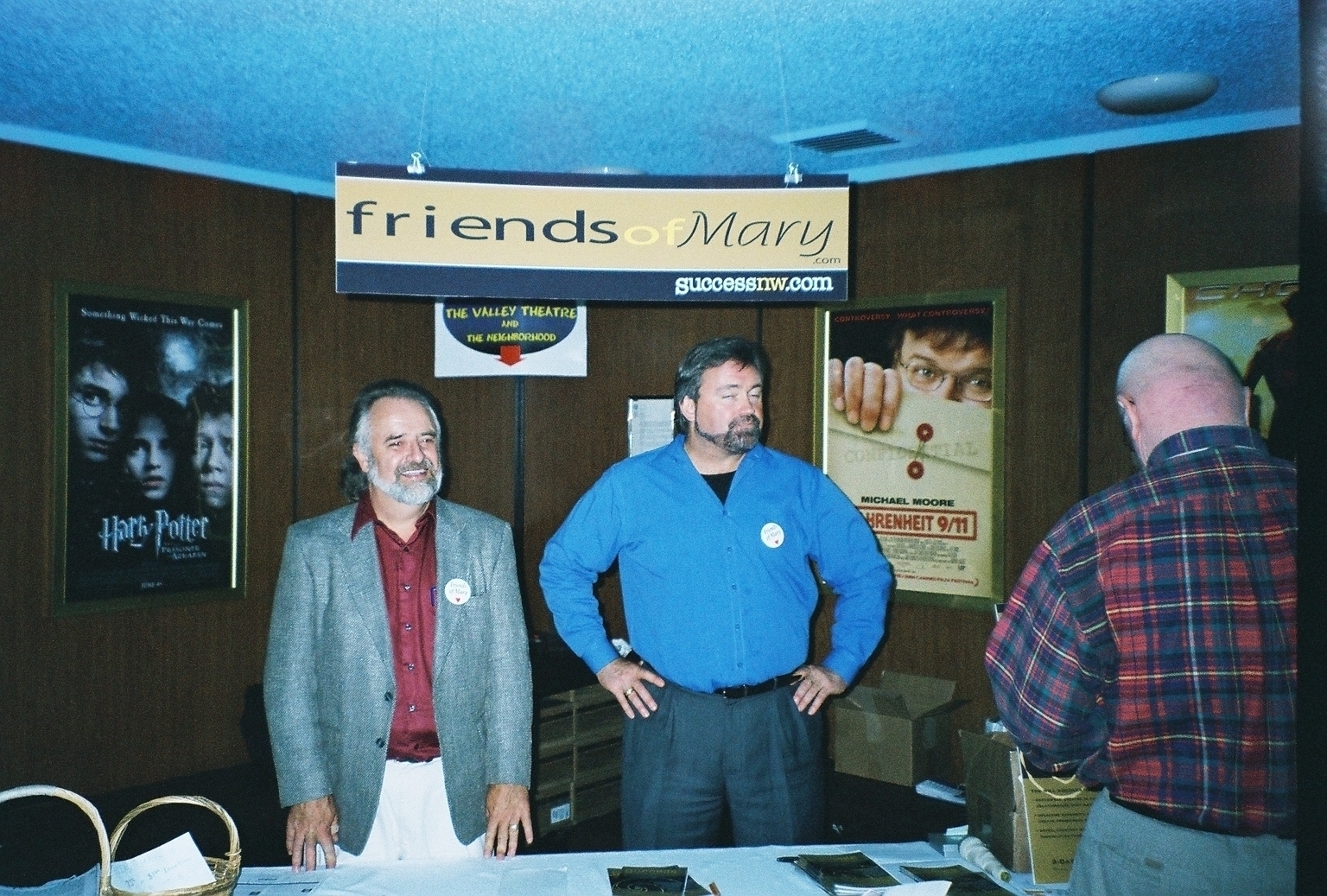
Friendsofmary
Image description: I took this picture in 2004 at the last Living Enrichment Center church service, held at Valley Theatre in Beaverton. This is the lobby of the Valley Theatre. Mary Manin Morrissey's group "Friends of Mary." Note, both men are wearing buttons that read "Friends of Mary." The sign above their heads advertises Mary Manin Morrissey's two websites at that time, "friendsofmary.com" and "successnw.com." Behind the men one can see posters of upcoming movies. Pictured are Friends of Ma
Wikimedia Commons (public domain)

Aerial view of Sunset Highway and surrounding area - Washington County, Oregon
Aerial view of Sunset Highway and surrounding area in Washington County, Oregon. This view is looking southwestwards from above the Cedar Mill area. The freeway running across the frame is the Sunset Highway (U.S. Highway 26), with its Cornell Road and nearby Bethany Blvd. overpasses and interchanges visible just to the left of center. The Oak Hills neighborhood is in the center of the frame. Sunset High School's athletic fields are at the far left, but the school itself is just out of frame.
Wikimedia Commons (public domain)

Beaverton Depot for Oregon Electric Railway (Beaverton, Oregon Historical Photo Gallery) (247)
Beaverton Depot for Oregon Electric Railway. Historical images of Beaverton, Oregon.
Wikimedia Commons (public domain)

Filming Nutria Habitat in Beaverton, Oregon 022-DP-06417
Film crew filming in Beaverton, Oregon for the USFWS and Pangolin Film's effort to create awareness surrounding the dangers of the spreading non-native nutria populations in the northwest region.
Wikimedia Commons (public domain)
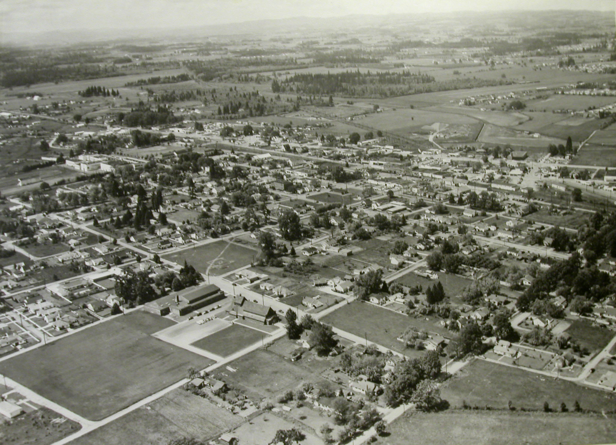
View of Beaverton 1950's (Beaverton, Oregon Historical Photo Gallery) (10)
View of Beaverton 1950's. Historical images of Beaverton, Oregon. This view is looking northwest (from approximately above 11th or 12th & Alger) towards downtown. St. Cecilia Catholic Church is visible at the north end of the large open lot in the lower left quandrant of the frame. The two north–south streets that go out of frame at the bottom of the photo are Franklin Street (left) and Lombard Street (now Lombard Avenue). The east-west arterial street in the upper part of the frame is High
Wikimedia Commons (public domain)

Madness, By The Bottle (Unsplash)
New Seasons Market Cedar Hills, Beaverton, United States
Wikimedia Commons (cc0)

Possibly some early farmhouses in what is now downtown Beaverton (Beaverton, Oregon Historical Photo Gallery) (267)
Possibly some early farmhouses in what is now downtown Beaverton. Historical images of Beaverton, Oregon.
Wikimedia Commons (public domain)