
Photo Gallery
Community photos and memories
No photos found.
Community Photos
Photos from local communities and photographers

Atchison, Kansas (circa 1880-1900)
Photograph shows a view of the rail yard beneath the lower Sixth street viaduct on the east side of Atchison, Kansas. Also visible are freight cars (including Missouri Pacific, Texas & Pacific, Kansas City, Fort Scott, & Memphis railway cars), and the business, church, and residence buildings of eastern Atchison.
Wikimedia Commons (public domain)

Atchison 1880 - 00237493
Lithograph shows aerial view of Atchison, Kansas, in 1880.
Wikimedia Commons (public domain)

Atchison County, Kansas, June 17, 2015 -- A Preliminary Damage Assessment (PDA) Team looks at a washed out road and culvert in Atchison County caused by heavy rains. FEMA and the St - DPLA - 8c062a17b30c57b8fa7f077741dca50a
The original finding aid described this as: Date Taken: 2015-06-17 11:12:11 UTC Photographer name: Steve Zumwalt City/State: Atchison, KS Disaster Types: Flooding ^ Severe Storm Categories: Feature Stories ^ Federal Partners ^ Miscellaneous ^ Public Assistance ^ State/Local Officials
Wikimedia Commons (public domain)

EARLY MORNING VIEW FROM A BLUFF AT ATCHISON, KANSAS OVERLOOKING THE MISSOURI RIVER AND PLAINS TO THE EAST. THE... - NARA - 557095
Wikimedia Commons (public domain)

EARLY MORNING VIEW FROM A BLUFF AT ATCHISON, KANSAS OVERLOOKING THE MISSOURI RIVER AND PLANS TO THE EAST. THE... - NARA - 557096
Wikimedia Commons (public domain)
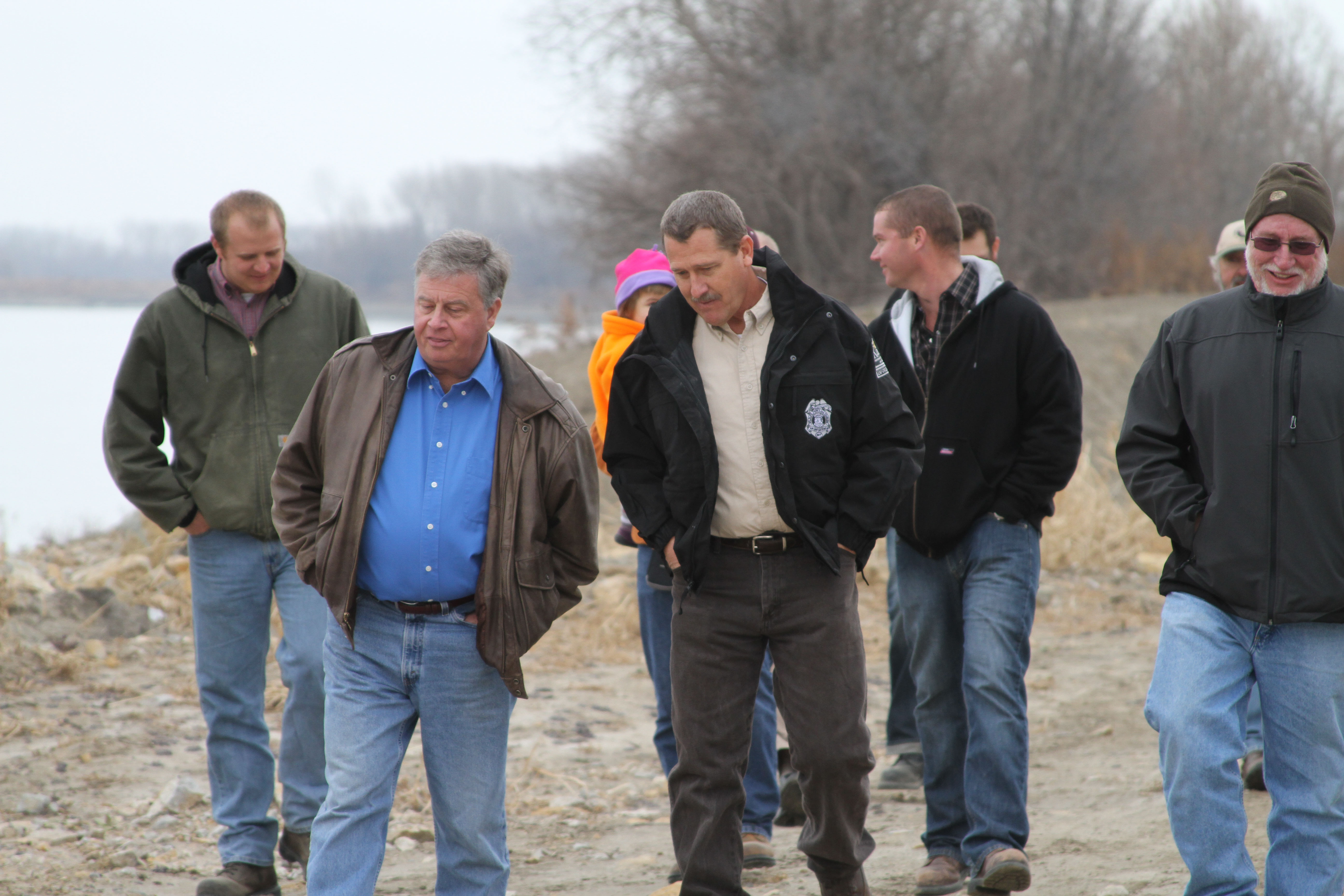
Tour of Dalbey Bottoms (8268344094)
Allen Reavis (blue shirt), the mayor of Atchison, Kan., and Kirk Thompson (tan shirt), a public land manager for the Kansas Department of Wildlife, Parks and Tourism tour Dalbey Bottoms on Dec. 7, 2012. A ribbon cutting ceremony was held to commemmorate the completion of three chutes along the Missouri River. U.S. Army Corps of Engineers photo by Amy Phillips.
Wikimedia Commons (public domain)