
Tropical Storm Isaias: Jacksonville Braces for Heavy Rain & Tornadoes
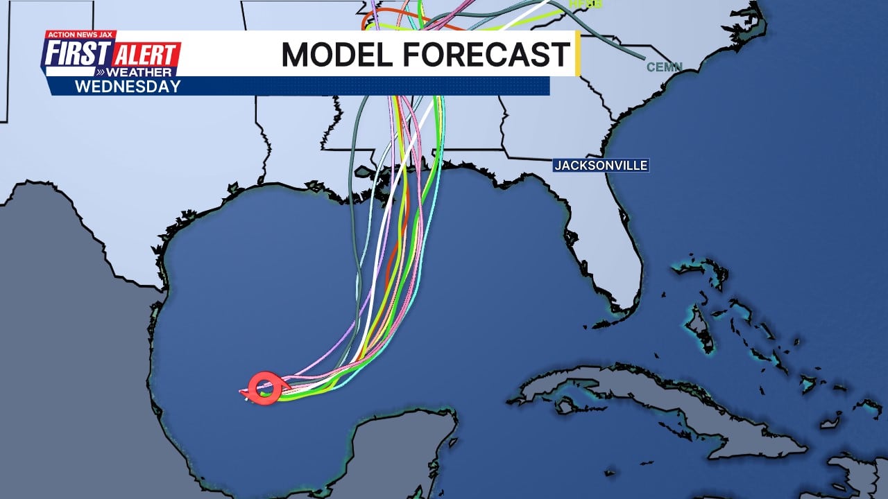
Tropical Storm Isaias is expected to bring heavy rain and isolated tornadoes to Jacksonville starting Friday. Areas along the St. Johns River could see the worst of the squalls as the storm approaches the Gulf Coast.
Advertisement
Jacksonville residents should prepare for increased tropical moisture and the potential for heavy rain and isolated tornadoes as Tropical Storm Isaias approaches the Gulf Coast later this week. The storm's core is forecast to remain west of the city, but Jacksonville will be on the eastern edge of its circulation, potentially bringing the brunt of squalls to areas along the St. Johns River.
The National Hurricane Center's Wednesday update projected Isaias would strengthen into a hurricane before making landfall between Louisiana and the Florida Panhandle over the weekend. Coastal and inland areas from the Florida Panhandle to Louisiana are advised to prepare for hurricane conditions.
For Jacksonville, the primary impact will be an influx of tropical moisture, leading to periods of heavy rain from Friday into Saturday. Meteorologists predict this could cause localized flooding, particularly in areas like San Marco. The National Weather Service is also monitoring the possibility of tornadoes developing within the storm's outer bands.
In response to the potential impacts, Florida Governor Ron DeSantis issued a state of emergency for 25 counties Tuesday night. While Jacksonville was not explicitly named, the declaration includes Baker and Columbia counties in the broader Northeast Florida region. The order aims to facilitate the staging of critical preparedness resources across the state.
Related Topics
Article Ratings
How do you feel about this story?
Michelle Foster
Sign in to follow this author from their profile.





Discussion (0)
Join the Conversation
Join the conversation
Sign in to share your thoughts, reply to readers, and like comments.
No comments yet. Be the first to comment!