
Orlando Heat, Humidity, Rain Expected This Week
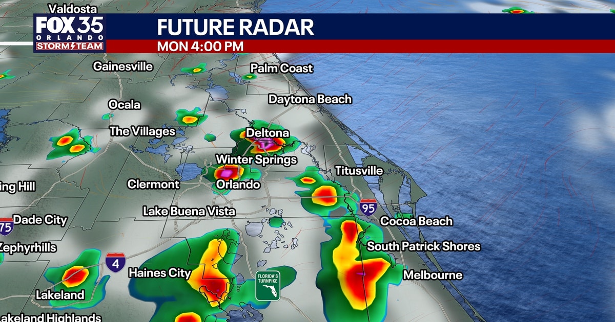
Orlando residents will start the work week with high temperatures reaching the low 90s, accompanied by oppressive humidity that could push heat indices between 102°F and 107°F. Scattered showers and thunderstorms are forecast for this afternoon, likely forming west of I-95 before moving inland late in the day.
The FOX 35 Storm Team predicts a greater chance of rain later in the week and into the weekend due to an influx of tropical moisture. These stronger storms could bring heavy downpours, frequent lightning, and localized wind gusts from 40 to 50 mph.
The weather pattern begins to shift Tuesday as high pressure strengthens along the East Coast. This will increase east-northeast winds, becoming noticeably stronger by Wednesday with sustained speeds of 15-20 mph and higher gusts near the coast. This persistent onshore flow is expected to create rough surf, building seas, and a high risk for dangerous rip currents by Wednesday. Offshore seas could reach 6-8 feet, particularly north of Cape Canaveral.
Rain chances remain elevated Tuesday and are expected to increase Wednesday, Thursday, and throughout the weekend. By Thursday, scattered to numerous showers and thunderstorms are anticipated across much of Central Florida. Repeated rainfall in coastal areas may lead to localized urban flooding, especially in areas already saturated.
Looking ahead to the weekend, deeper tropical moisture is forecast to return as the upper-level pattern shifts west of Florida. This will maintain elevated daily chances for rain and thunderstorms. High temperatures from Wednesday through the weekend are expected to range from the upper 80s to the low 90s.
The National Hurricane Center is monitoring a disturbance more than 1,000 miles from Bermuda. It poses no direct threat to Florida, with a 30% chance of development over the next seven days.



Discussion (0)
Join the Conversation
No comments yet. Be the first to comment!